A picture of Wadi Darbat in the Governorate of Dhofar in the south of the Sultanate of Oman
No description available
A picture of Fence Beach in the Wilayat of Quriyat in the Sultanate of Oman, archaeological tourist attractions in the Sultanate of Oman, the beauty of the scenic landscape
No description available
The sunken stranded ship in the Wilayat of Salalah in the Aftalqout area in the Governorate of Dhofar in the Sultanate of Oman. Tourist attractions and stunning nature that attract tourists in the Sultanate of Oman
No description available
A panoramic picture of the mountains shining in Dhofar in the Sultanate of Oman, famous landmarks, stunning landscapes, the beauty of trees and green plants, sky and clouds, nature background, tourism in Oman
No description available
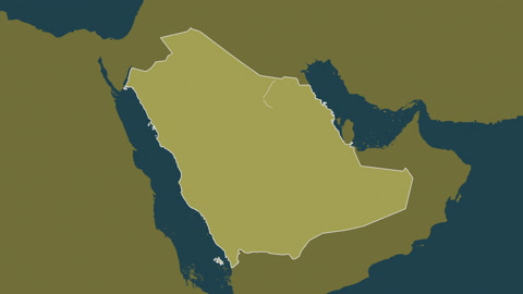
Determine the location and national geographical borders, a map of the Arab world and the Gulf countries, placing and installing a marker over the State of Qatar, Arab cities and countries.
No description available
Ain Jarziz in Dhofar Governorate, tourist places for hiking in Salalah Governorate in the Sultanate of Oman, enjoying the natural scenery among the trees and dense green plants on the mountains, and natural water bodies on the mountain slopes and foothills